
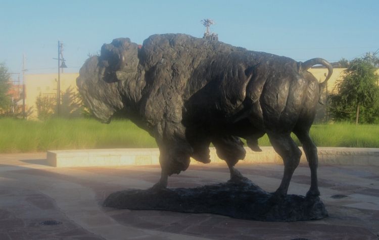
Amon G. Carter used to say, “Fort Worth is where the West begins. Dallas is where the East peters out.” It was a nicely phrased line. Just one problem. That identifier (“Where the West Begins”) could be applied more accurately to a different locale. Like, maybe, Abilene. Or even Merkel.That’s because either of those burgs lies nearer the 100th Meridian than does Fort Worth. And the 100th Meridian is the longitudinal line that traditionally has been viewed as the dividing line, in America and Canada, between East and West.
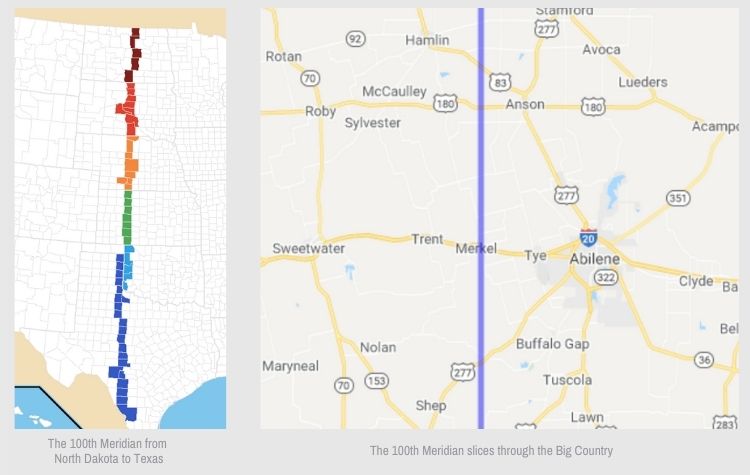
The 100th Meridian slices through the Big Country, north to south. (See the two accompanying maps below. See also what the Howder Family has to say.) It bisects these Texas counties (among others): King, Stonewall, Jones, Taylor, Runnels, Concho.
What makes the 100th meridian significant?
What makes the 100th Meridian significant? Rainfall—the rainfall west of the line is considerably lower than east of it. And so the land changes as well. With less rainfall to the west of the line, crop production there becomes less common, and grazing predominates as the agricultural practice of choice.
The 100th also is where the population density drops dramatically, east to west. That makes sense. Farming (as compared to grazing) is a bigger deal east of the 100th than west of it. Accordingly, tillage requires more man-hours per acre than pasturage does. Thus, we should expect to see a more concentrated labor force on one side (east) than on the other.
 Conversely, land to the west of the line appears less “settled,” less “civilized,” and more in its pristine state. The land west of the line conforms more closely with what Americans think of as the rugged, untamed expanses of the nation’s outback.
The counties in “our part” of Texas that fall on the 100th are these, north to south: King, Stonewall, Jones, Taylor, Runnels, Concho.
Here’s how Wikipedia describes the dividing line:
“In the central Great Plains, the 100th Meridian roughly marks the western boundary of the normal reach of moist air from the Gulf of Mexico and the approximate boundary (although some areas do push the boundary slightly farther east) between the semi-arid climate to the west and the humid and the humid-subtropical climates to the east.”
Now for a surprise:
In 2018, TexasObserver.org ran this headline: “Austin’s on the Wrong Side of the 100th Meridian.”
What they meant by that cryptic title is this:
“The invisible line that divides the arid western part of the country from the wetter eastern half is on the move.”
That’s right. They were saying that the longitudinal line was shifting. Of course, that’s just saying so in a manner of speaking. The 100th Meridian will always occupy its current longitude. But the conditions that we associate with the 100th—those conditions might be migrating further east.
Said the Observer: “In Texas, the 100th meridian cuts down the right-hand side of the Panhandle, through Childress, down to Abilene and past Laredo before pushing south into Mexico. Areas to its west tend to be warmer and drier… The line is also thought to demarcate a cultural, political, agricultural, and social boundary in the United States. Columbia University researchers made [in 2018] a bombshell discovery: The 100th Meridian is on the move. The 100th Meridian—in the sense of a dividing line between the western and eastern halves of the country—is now closer to the 98th Meridian.”
The Observer‘s report cited 19th century western explorer John Wesley Powell as the man who first observed and publicized the geographical differences marked by the 100th Meridian. At the time (1870s) Powell urged lawmakers to dissuade settlers from living west of it because of the scarcity of drinking water.
Speaking of more modern circumstances, the Observer remarked: “In the Columbia study, scientists found that the 100th had moved [and] that’s a problem for Austin, which is now west of the line for the first time. For reference, the meridian’s shift is equivalent to moving from Mineral Wells to Arlington, or from Lampasas to Temple.”
Apparently Austin doesn’t want to think of itself as lying within a hot, dry climate. Or inside the wild West.
Meanwhile, Columbia University, for its own part, had this to say in its State of the Planet blog: “Warming climate appears to be pushing the divide east…. This is pushing aridity eastward…. The statistical divide between humid and arid has now shifted some 140 miles east. (In Texas, this would move it roughly from Abilene to Fort Worth.)”
So what does it all mean?
Not that much. Folks in these parts are used to dry western conditions and frontier living. We were already part of the West, or right on the border of it. If the line moves further east, that’s just lucky for the folks there who formerly had to call themselves “Easterners.”
And as for you, 100th Meridian… shift if you want. We can’t stop you.
Just stop short, please, of where the East peters out.